Unless otherwise posted per City Council resolution, when a park is closed, no person shall remain in or enter it other than to quietly sit or walk.
Refer to Chapter 39 of the City of Ann Arbor Code of Ordinances for park regulations and rules.
South Pond Nature Area is a 16-acre natural area located on Huron River Drive and south of Gallup Park and the railroad tracks, just east of Huron Hills Golf Course. View the Ann Arbor Parks & Nature Areas Map for location context. South Pond is comprised several disconnected areas of land surrounding a large pond. The most visible part of the park is the pond itself, to which Chalmers and Malletts Creek drain. This area has an interesting natural history as the pond was once a prairie, before the Dixboro Dam was constructed, and is now becoming a marsh. Across the pond is a piece of land that is a beautiful example of an oak savanna. This natural area is being restored by the staff and volunteers of the Natural Area Preservation unit. This includes prescribed burns and removal of non-native invasive plants.
South Pond is also home to the Natural Area Preservation (NAP) office. NAP works to protect and restore Ann Arbor’s natural areas and to foster an environmental ethic within the community.
Park NoticesUnless otherwise posted per City Council resolution, when a park is closed, no person shall remain in or enter it other than to quietly sit or walk. Refer to Chapter 39 of the City of Ann Arbor Code of Ordinances for park regulations and rules. |
Park Hours6 a.m. – Midnight |
Some parking is available at the Natural Area Preservation (NAP) office at 3875 E. Huron River Drive, but space is very limited.
There are no sidewalks or bike lanes along Huron River Drive.
There is no bus stop within a 20 minute walk of South Pond. Check out TheRide Guide for more details.
Ann Arbor's city parks sit on the ancestral and traditional homelands of several indigenous Native peoples. Read a land acknowledgement from the city and learn more about the early history of the land here.
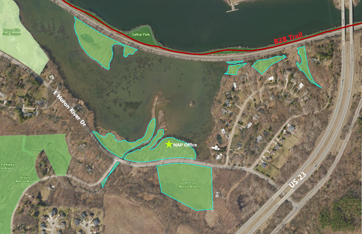
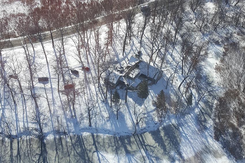
South Pond Nature Area was once a prairie. Around 1918 there was a railroad that was developed in the prairie area. Later on Swift Run Creek was dammed and the rerouted towards Mallets Creek. The combination of building the railroad, rerouting the river, river level rising due to damming the river and the impact of dredging created South Pond. The parcel that the Natural Area Preservation (NAP) office resides on was purchased by the city in 2009, although the occupants remained in the home on a life estate plan until 2013. In 2013, the parcel became park land as a part of South Pond. NAP's offices moved to the building here in 2014.
Read a NAP newsletter highlighting the history and natural features of South Pond, which was about to become home to NAP's office:
2014 South Pond—Prairie, Pond, Marsh...Home by Dave Borneman
Looking to make an impact in a park or nature area? Ann Arbor Parks and Recreation provides volunteer opportunities for almost every interest, ability, and commitment level.
Discover parks and find amenities through the City of Ann Arbor Park Finder. This map allows you to search park names or search by amenity type or keyword.
A2 Fix It is an online system you can use to report any maintenance issues or other problems during your park visit. When reporting an issue in a park please include detailed location information in the "details and description" section near the end of the request process. Pictures that provide location context are very helpful.
This website uses cookies to enhance usability and provide you with a more personal experience. By using this website, you agree to our use of cookies as explained in our Privacy Policy.