Skip to main content Skip to footer

Narrow Gauge Way Nature Area

Overview

Narrow Gauge Way is a 13.5 acre nature area located on the north​​east side of Ann Arbor, just south of the corner of Green Road and Glazier Way. View the Ann Arbor Parks and Nature Areas map for location context.

​​Narrow Gauge Way Nature Area is one of a number of city park properties with no trails or amenities. These natural areas represent a unique recreation and conservation feature of the city’s park system. In these relatively few spaces across the city, off-trail exploration is encouraged– a rare opportunity to meander through a wild space in our urban context. Visitors are also invited to reflect on the conservation value and biodiversity of these spaces, where the Parks & Recreation’s Natural Area Preservation staff and volunteers work to steward, restore and inventory the natural communities throughout the city’s parks.​

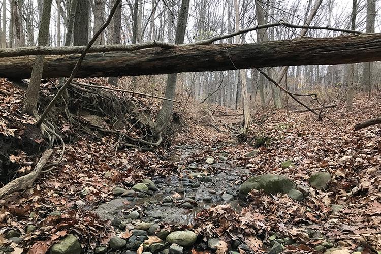
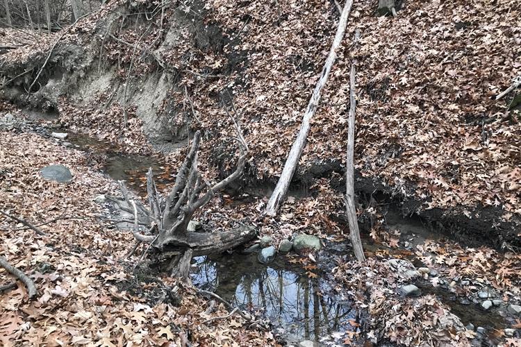
​The diverse trees located throughout the area provide habitat for terrestrial wildlife including rabbits, deer, and squirrels. ​Just some of the many nati​ve plant species found here include oak, hickory, maple, sycamore, sassafras, basswood, and black walnut trees as well as ragwort, jack-in-the-pulpit, richweed, Christmas fern, and lopseed.​​ The creek that flows through Narrow Gauge Way is a small branch of Millers Creek, which is the steepest tributary to the Huron River in all of Ann Arbor! ​

Park Notices

Unless otherwise posted per City Council resolution, when a park is closed, no person shall remain in or enter it other than to quietly sit or walk.​

Refer to Chapter 39 of the City of Ann Arbor Code of Ordinances for park regulations and rules.


Park Hours

6 a.m. – Midnight

Access and Parking

​There is limited street parking available on Narrow Gauge Way​, on the north side of the nature area​​.

The nature area is accessible on foot at two unmarked entry points: one where Narrow Gauge Way and Watersh​ed Court meet, and one where the west edge of the nature area property borders Green Road. For both access points, the incline down to the stream bed requires caution and steady footing. Once in the area, discernible footpaths can be found, especially along the streambed located in the northern end of the nature area.​

Public Transportation

The ne​a​rest bus stop is at the corner of Glazier Way and ​Bardstown Trail, which is about a half mile away and a 10-15 minute walk from the nature area. Visit TheRide​ for closest stops and route details or check out the parks ride guide​​. ​​​​

Volunteer in the parks

Looking to make an impact in a park or nature area? Ann Arbor Parks and Recreation provides volunteer opportunities for almost every interest, ability, and commitment level.

Learn more about volunteer opportunities

Park Finder

Discover parks and find amenities through the City of Ann Arbor Park Finder. This map allows you to search park names or search by amenity type or keyword.

View the Park Finder

A2Fix It - Service request tool

A2 Fix It is an online system you can use to report any maintenance issues or other problems during your park visit. When reporting an issue in a park please include detailed location information in the "details and description" section near the end of the request process. Pictures that provide location context are very helpful.

Submit a request

This website uses cookies to enhance usability and provide you with a more personal experience. By using this website, you agree to our use of cookies as explained in our Privacy Policy.