Rezoning Washtenaw - East Stadium and Plymouth Corridors to TC1 district

Rezoning Washtenaw/East Stadium and Plymouth Corridors to TC1 district
Introduction
City Council asked Planning Commission to create a new zoning district for transit corridors, and asked for recommendations on which areas in the city may be appropriate for the new district in Resolution R-20-439 (approved November 16, 2020). The new district, TC1 (Transit Corridor), was adopted by Ordinance no. ORD-21-19 (approved 7/6/21, effective 7/25/21). The first area to be rezoned was in the South State and East/West Eisenhower area, approved in April 2022. Then, the West Stadium/North Maple Corridor was rezoned by City Council Ordinance ORD-22-16 (approved 11/15/22, effective 11/27/22).
Since that time, the City Council has requested several amendments to the TC1 Zoning District (Resolution R-22-390, approved 12/5/22) and has directed the prioritization of rezoning the Plymouth and Washtenaw Corridors (Resolution R-23-186, approved 6/5/23).
About the TC1 Transit Corridor District
The TC1 (Transit Corridor) district is intended along existing transit corridors with regular fixed service provided by AAATA primarily on established commercial and office sites. It was created to facilitate, encourage, and support redevelopment and infill development to realize mixed use projects and achieve affordable housing, enable more housing choices, more sustainable forms of development, with reduced resource and energy needs.
Proposed Plymouth Road TC1 Transit Corridor District Area
The Plymouth Road corridor includes three areas proposed for rezoning to the TC1 Transit Corridor District.
Download TC1 Transit Corridor Map.
Western Plymouth Road corridor near Upland & Murfin:

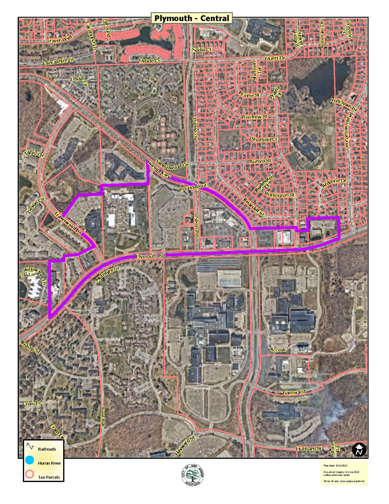
Central Plymouth Road corridor, approximately between Beal Avenue and Georgetown Blvd:
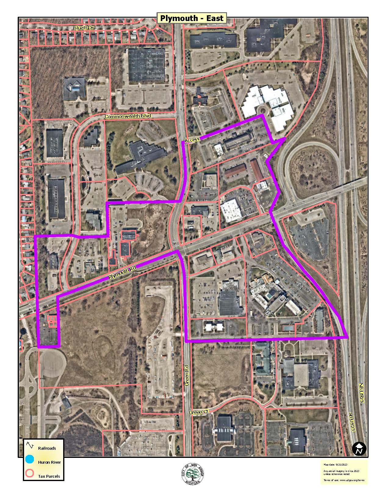
Eastern Plymouth Road corridor, approximately between Commonwealth Blvd and US 23:
Proposed Washtenaw/East Stadium Avenue TC1 Transit Corridor District Area
The Washtenaw Avenue corridor includes two areas proposed for rezoning to the TC1 Transit Corridor District designation.
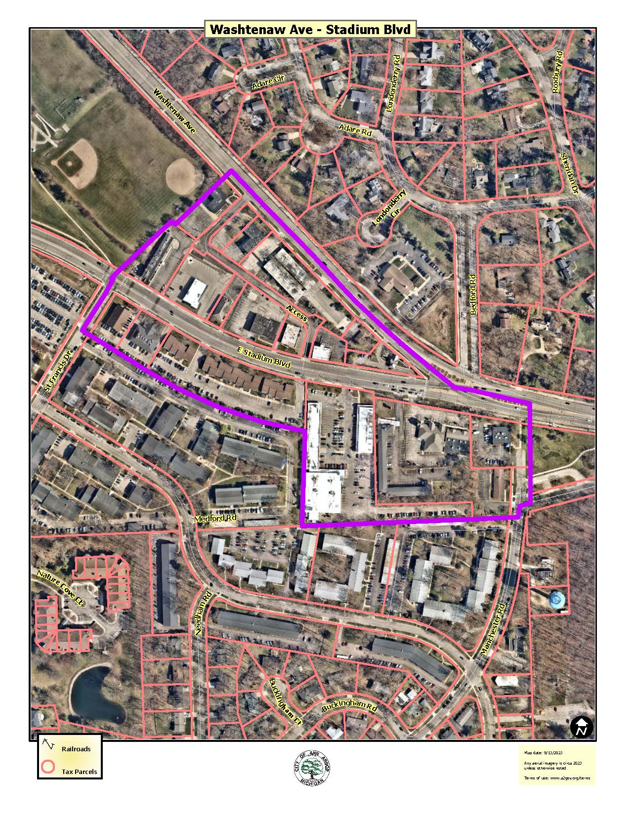
Washtenaw Avenue/East Stadium Blvd:
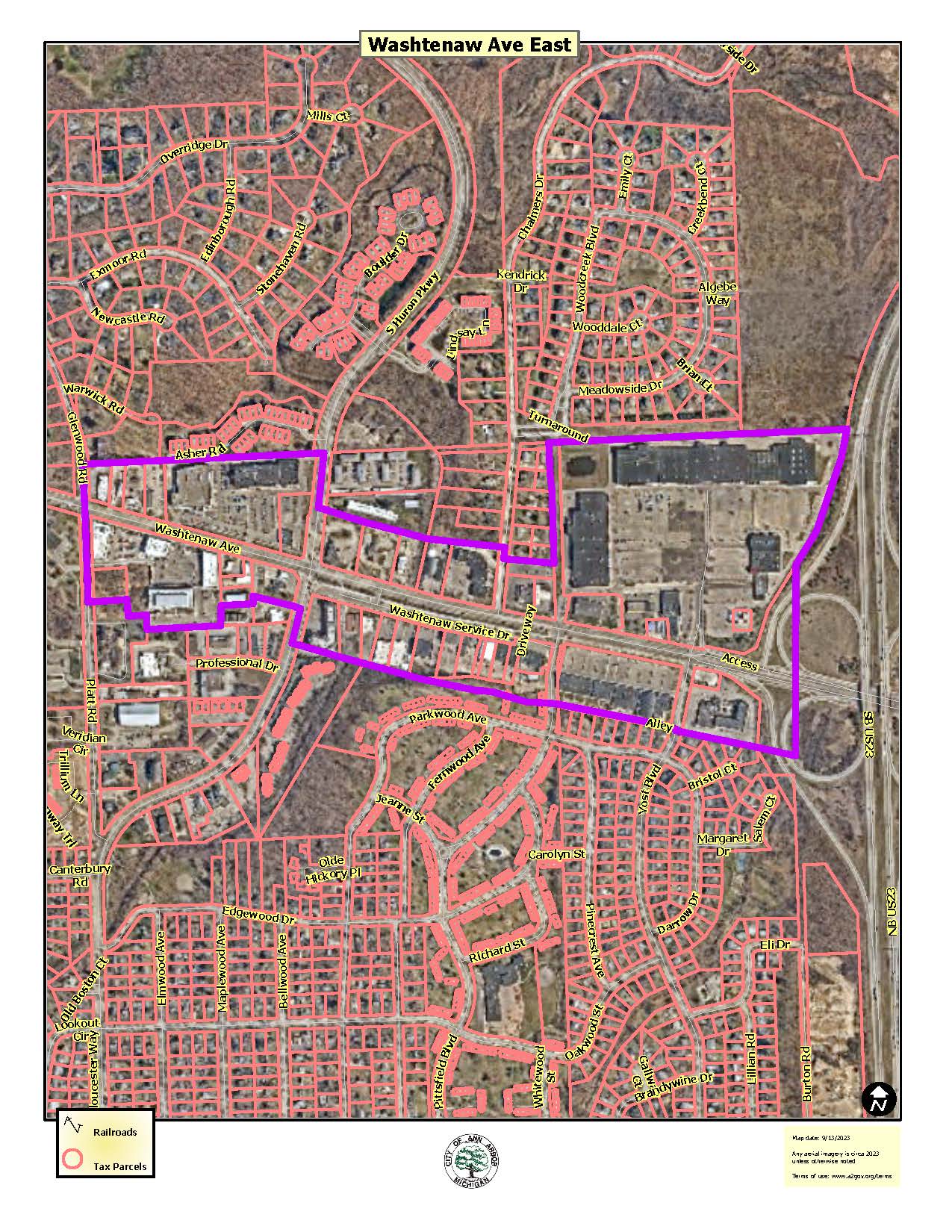
Washtenaw Avenue from Platt Road to US 23:
Interactive Mapping Tool
The TC1 Transit Corridor District has a variable height limit depending on how far a building is from a residential zoning district. Maximum height limits in the TC1 District start at 55 feet and increase as distance increases (to a maximum height of 300 feet). Use this interactive mapping tool to see the TC1 district variable height limits on any site in these proposed areas.
Upcoming Events
- None scheduled at this time
Resources and Materials
Washtenaw area Rezoning Public Meeting - November 16, 2023
- Presentation Slides (Nov 16, 2023 Meeting)
- Frequently Asked Questions Washtenaw (Nov 16, 2023 Meeting)
Plymouth area Rezoning Public Hearing - November 1, 2023 Planning Commission meeting
- Presentation Slides (Nov 1, 2023 Hearing)
- Summary Report (Oct 12, 2023 Meeting)
- Staff Report: Plymouth Road Area Rezoning to TC1 (November 1, 2023)
- Ordinance: Plymouth Road Area Rezoning to TC1, Attachment to Staff Report (October 26, 2023)
Plymouth area Rezoning Public Meeting - October 12, 2023
- Frequently Asked Questions Plymouth area (Oct 12, 2023)
- Presentation Slides (Oct 12, 2023 Meeting)
- Property Owner Packet - city-initiated rezoning of Plymouth Rd areas to TC1 district (September 21, 2023)
General
- Proposed TC1 Plymouth Rd - Murfin - Upland Aerial Map
- Proposed TC1 Plymouth - East Aerial Map
- Proposed TC1 Plymouth - Central Aerial Map
- Proposed TC1 Washtenaw Ave - Stadium Blvd Aerial Map
- Proposed TC1 Washtenaw Ave East Aerial Map
- Proposed Plymouth Corridor TC1 District - Parcel Information
- Washtenaw Corridor TC1 Zoning - Parcel Information
301 E. Huron Street, Ann Arbor, MI 48104
 734.794.6265

Brett Lenart AICP,
Planning Manager
734.794.6000 x42606
Connect with Us


Payment questions: